
Northeastern Gulf Low Pressure System Could Bring Heavy Storms Along Gulf Coast

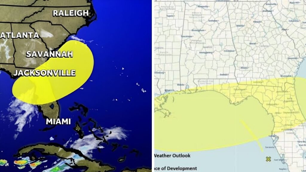
A developing weather pattern over the eastern Gulf is drawing attention as thunderstorms increase near Florida. The setup is not yet a named tropical system, but it could still create disruptive weather along parts of the Gulf Coast. Forecasters are mainly concerned about repeated downpours, slow-moving storms, and localized flooding from Florida’s west coast to the Panhandle. Some effects could also extend into southeast Alabama and southwest Georgia during the next several days. The severity of the weather may vary considerably between communities.

Northeastern Gulf Low Pressure System Takes Shape
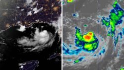
The northeastern Gulf low pressure system is connected to an upper-level low and a surface trough producing showers and thunderstorms over the eastern Gulf. The National Hurricane Center said gradual development remains possible as the disturbance moves slowly north or north-northwest. As of the morning of July 18, it had a 20 percent chance of formation within 48 hours and a 30 percent chance over seven days. Even without tropical development, the system is expected to bring heavy rain to portions of Florida.
Heavy Rain Is the Main Concern
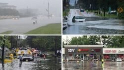
Rainfall is expected to be the most widespread impact. Deep tropical moisture is moving north ahead of the slow-moving disturbance, creating conditions where thunderstorms can produce intense rain within a short period.
 New Jersey Weather Rainfall Totals Show More Than 3 Inches of Rain Fell Across Several Towns
The Weather Prediction Center warned that storms across the Florida Panhandle, southeast Alabama, and southwest Georgia may move slowly. This could lead to high rainfall totals and isolated flash flooding. A marginal excessive-rainfall risk was also maintained from the Tampa Bay region to the Florida Panhandle for Monday. Urban streets, low-lying communities, and places with poor drainage could experience rapid water buildup.
Florida Could See Repeated Downpours
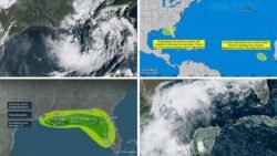
The National Weather Service in Jacksonville expects waves of downpours and thunderstorms on Sunday and Monday as the weak low moves toward the Florida Panhandle. People with outdoor plans are being encouraged to identify safe shelter and check updated forecasts before traveling.
Farther west, the Mobile-Pensacola forecast office also expects the low to develop over the northeastern Gulf and slowly move north. Scattered afternoon storms are likely to continue across coastal Alabama and northwest Florida while the system remains nearby.
Tropical Development Chances Remain Limited
Warm Gulf water can support tropical organization, but surface observations currently show relatively high pressure and generally light winds around the disturbance. Its exact formation location will play an important role in determining whether it becomes better organized.
A center forming close to land would have less time over open water, reducing its development opportunity. A center farther offshore could have more time to strengthen. Forecast models have shown some disagreement, meaning the system’s path, organization, and rainfall coverage could change as fresh information becomes available.
Gulf Coast Communities Should Stay Alert
People along Florida’s west coast and Panhandle should follow National Hurricane Center and local weather updates throughout the weekend. The disturbance is not currently expected to become a major hurricane, but the flooding threat should still be taken seriously.
Drivers should avoid water-covered roads, boat operators should monitor changing marine conditions, and families with outdoor plans should prepare for sudden thunderstorms. The system shows that even a poorly organized low can produce dangerous rainfall without receiving a tropical storm name.
Sources
- National Hurricane Center: The disturbance had a 20 percent two-day formation chance and a 30 percent seven-day chance on July 18.
- Weather Prediction Center: Slow-moving storms could cause heavy rainfall and isolated flash flooding across the eastern Gulf Coast region.
- FOX 35 Orlando: Florida could receive repeated downpours even if the disturbance fails to become a tropical storm.
- CBS News Miami: Forecast models showed disagreement about whether an organized tropical system would develop.
- Chron: The disturbance was projected to move around northern Florida, the eastern Gulf, and possibly the western Atlantic.
