
Hurricane Genevieve Strengthens Across the Pacific as Fausto Weakens Near Hawaii

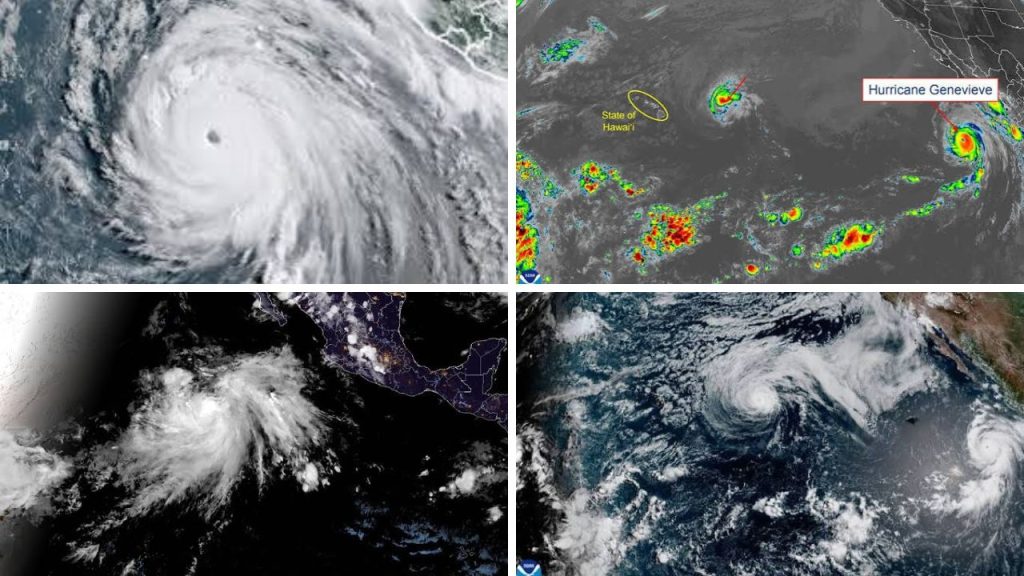
Hurricane Genevieve has become the dominant storm in the eastern Pacific after a burst of rapid intensification pushed it briefly to Category 5 strength. By Monday evening, July 27, 2026, it had eased slightly but remained a powerful major hurricane with sustained winds of 145 mph. The system was still far from land and moving northwest, roughly parallel to Mexico’s coast. At the same time, Fausto was weakening near Hawaii, creating a very different risk pattern centred on high surf, strong currents and periods of heavier rain.

Tropical Storm Fausto Near Hawaii
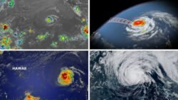
Tropical Storm Fausto weakened from hurricane strength as it moved west-northwest towards the Hawaiian Islands. At 5 p.m. HST on July 27, the storm had maximum sustained winds of 70 mph and was about 415 miles east-northeast of Hilo. Forecasters expected its centre to pass north of the main islands on Tuesday and Wednesday. Even without a direct landfall, Fausto’s broad circulation was already sending larger waves towards east-facing shores. Residents, visitors, fishers and boat operators were urged to follow local alerts because coastal conditions could become dangerous before the storm makes its closest approach.
Genevieve Remains a Powerful Major Hurricane
Genevieve’s development was much more dramatic. The hurricane reached 160 mph early Monday, making it the first Category 5 storm in the eastern Pacific since 2024. It later weakened to Category 4 strength, but its compact and intense core remained over open water southwest of Baja California. No coastal watches or warnings were in effect because the forecast track kept the centre offshore. However, the lack of a landfall threat did not mean the storm was harmless. Large swells were spreading towards southwestern Mexico and the Baja California Peninsula, increasing the risk of life-threatening surf and rip currents.
High Surf Becomes the Main Coastal Hazard
For Hawaii, Fausto’s most certain impact is high surf. The National Weather Service in Honolulu placed a High Surf Warning in effect for several east-facing coastal areas through Wednesday afternoon. Waves were expected to peak on Tuesday, while rough seas also prompted Small Craft Advisories for a number of channels and windward waters. Moisture linked to the weakening storm could bring heavier showers, especially over windward and mountain areas. Local rainfall totals of around half an inch to one inch were possible in some upland locations, although the heaviest storm-related rain was forecast to remain north and east of the islands.
Forecast Calls for Gradual Weakening
Both storms are expected to weaken, but for different reasons. Fausto is moving into a less supportive environment shaped by dry air, stronger winds aloft and cooler water near Hawaii. Genevieve should also lose strength later in the week as it tracks over cooler seas and encounters less favourable atmospheric conditions. Forecasts still allow for short-term changes in intensity, especially with a major hurricane as strong as Genevieve. Coastal communities should therefore focus on official advisories rather than the storm category alone. A system can remain offshore and still produce dangerous waves, rip currents, disrupted marine travel and sudden changes in local weather.
The wider message from the Pacific is one of contrast. Genevieve is the stronger cyclone, but Fausto is closer to populated islands. That makes local impact, not headline wind speed, the most useful measure of risk. People near exposed beaches should respect closures and warning signs, while travellers should check transport updates and changing forecasts.
Sources
- National Hurricane Center — Genevieve had 145 mph winds, while Fausto had weakened to a 70 mph tropical storm on July 27.
- National Weather Service Honolulu — Fausto was forecast to pass north of Hawaii while producing high surf, increased moisture and possible heavy showers.
- Associated Press — Genevieve briefly became the eastern Pacific’s first Category 5 hurricane in two years without creating a direct landfall threat.
- AccuWeather — Genevieve peaked with sustained winds of 160 mph and was forecast to weaken gradually later in the week.
- The Weather Channel — Fausto could produce waves reaching approximately 16 feet along exposed Hawaiian shores, alongside gusty winds and localised heavy rain.
