
Tropical Storm Bertha Makes Second Landfall Near the Texas Louisiana Border Bringing Heavy Rain and Flooding

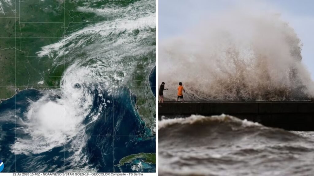
Tropical Storm Bertha Makes Second Landfall Near Texas Louisiana Border became one of the biggest weather stories in the United States after the storm returned to the Gulf Coast and moved ashore a second time. Parts of southeastern Texas and southwestern Louisiana reported heavy rain, gusty winds and flooding concerns with the storm. Bertha is expected to weaken over land but weather officials say heavy rain could continue to create dangerous conditions in some communities.
 5.1 Magnitude Earthquake Strikes Near Miami Texas as USGS Reports Shaking Across the Region
Why did Tropical Storm Bertha cross land again?
After initially moving across southeastern Louisiana, Bertha briefly re-emerged over the warm waters of the Gulf of Mexico. The storm then moved west and made its second landfall near the Texas Louisiana border. The unusual track of the system, even as it stayed a tropical storm, prolonged the period of heavy rain and coastal impacts across several Gulf Coast states.
 Preliminary 2.7 Magnitude Earthquake Reported Near San Leandro With Residents Feeling Light Shaking
Bertha made landfall with maximum sustained winds of about 45 mph (72 kph) about 75 miles north-east of Galveston, Texas, before weakening over land, the National Hurricane Centre said.
Which areas are expected to experience the greatest impacts?
The hardest hits are projected across south-east Texas and south-west Louisiana. Meteorologists are predicting 1 to 4 inches of rain, with isolated areas receiving more where rain bands move over the same areas repeatedly.
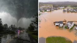
The most concern for flash flooding is urban neighbourhoods, low-lying communities and places with poor drainage. Parts of the Gulf Coast are also being affected by coastal flooding, dangerous rip currents and rough surf.
Is flooding occurring now?
Yes. The National Weather Service issued flash flood warnings for portions of Fort Bend and Harris counties, including Sugar Land, Missouri City and Stafford, due to heavy rain.
Emergency officials also reported flooded roads and warned drivers to stay off standing water, noting that most flood-related deaths occur in vehicles.
What warnings are still in force?
Tropical Storm Warnings are in effect for portions of the Gulf Coast from Morgan City, Louisiana, to Sargent, Texas.
Officials are telling people to be mindful of local forecasts as rain can linger long after a tropical storm begins to weaken. As Bertha moves further inland, localised flooding, isolated power outages and travel disruptions are still possible.
What’s next for Tropical Storm Bertha?
Forecasters expect Bertha to gradually weaken after making landfall. However, its moisture will continue to produce showers and thunderstorms across portions of Texas before gradually dissipating.
And while wind speeds are expected to diminish, flooding is generally the biggest threat in the final stages of tropical storms. People in flood-affected areas are advised to keep a watch on updated weather forecasts and avoid unnecessary movement in heavy rains.
References
National Hurricane Centre (NHC) – Official tropical storm advisories Storm path Second landfall location Max. sustained winds Forecasted path and warning information
Associated Press (AP) – Bertha’s second landfall near the Texas-Louisiana border, wind speed, forecast for rainfall, inland weakening, and broader storm impacts.
Houston Chronicle – Local flash flood warnings, flooded roads, affected Texas counties and emergency response.
AccuWeather – Forecast updates on rain amounts, flood risk, storm track, and coastal weather impacts.
Weather Channel – Tropical Storm Warnings, coastal flooding, dangerous surf and rip current threats.
