
Rare Atlantic Niña Is Emerging During a Super El Niño and Experts Explain What It Could Mean

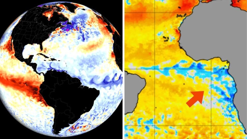
A potent Super El Nino continues in the Pacific Ocean and a rare Atlantic Nina is developing, an unusual climate combination in the making. Though the two climate patterns are in different oceans, experts say they could combine to affect hurricane activity, rainfall and temperatures in many parts of the world for the next several months.

What is Atlantic Niña?
Atlantic Niña is a climate pattern that refers to cooler than normal sea surface temperatures in the eastern equatorial Atlantic Ocean, mainly off the west coast of Africa. Not as famous as the Pacific La Niña, it can sometimes be less impactful on the globe. But it still influences tropical rainfall, atmospheric circulation and weather across the Atlantic region.

What is so strange about this?
Scientists say Atlantic Niña seldom develops during a strong or “Super El Nino” in the Pacific. Observations in history show that this combination has occurred only a handful of times in the past few decades. But the two ocean systems influence the atmosphere differently, and scientists are studying how they may interact and influence seasonal weather patterns.

Could it affect the Atlantic hurricane season?
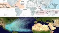
One of the biggest questions is how this weird arrangement of the ocean may impact hurricanes. Experts say the Atlantic Niña could improve atmospheric conditions that enhance wind shear over parts of the Atlantic. This, combined with the effects of a strong El Niño, could slow the development of tropical storms. But even in a lighter hurricane season, destructive storms can still develop, meteorologists say.
What would be the weather around the world?
A Super El Niño normally reshapes rain and temperature patterns over much of the globe. Some places may experience heavy rain and flooding. Drought, heat waves, less rain somewhere else. Atlantic Niña can also impact the amount of rainfall in some parts of West Africa and nearby tropical regions, but its influence is typically more regional than global.
Why is it being scrutinised so much?
Scientists are constantly watching the ever-changing ocean temperatures. Atlantic Niña is one of many factors that influence seasonal weather. Atmospheric circulation. Sea surface temperatures in other oceans. Regional weather patterns. All of them feed into one another . The more data we have the better the long term forecasts will be.
What Does This Mean for Humans?
This unusual combination of climate is a wake-up call for farmers, coastal communities, emergency planners and governments to be alert and ready for changing weather patterns. Scientists may not know all local impacts months in advance, but knowing these large-scale ocean patterns helps improve seasonal forecasts and disaster preparedness.
A Super El Niño with a Rare Atlantic Niña is a rare climate phenomenon that has attracted the world’s attention. Scientists say it will affect weather and hurricanes, but stress that no one climate indicator determines the outcome. Regular monitoring over the coming months will provide further insight into its real effects.
References
Gizmodo – Covered the development of Atlantic Niña during a Super El Niño noting the strangeness of this pairing.
Severe Weather Europe – Discussed the potential combined influence of Atlantic Niña and El Niño on hurricane activity and atmospheric circulation.
The Guardian – What are the likely global weather effects of a strong Super El Niño?
National Geographic – put into context how large El Nino events influence global climate, rainfall and temperatures.
